
The 2012 annual American Anthropological Association (AAA) meetings are once again in San Francisco, California (November 12-18). This year’s conference includes a workshop on GIS and cultural anthropology, co-organized by Andrew Tarter (website) and myself. The workshop is kindly sponsored by the Culture and Agriculture section of the AAA (website).The workshop has approximately 25 pre-registrations, one of the largest enrollments of any workshop at this year’s meetings. Participants received a 90+ page workbook introducing them to basic and intermediate geospatial techniques commonly used by anthropologists. The following post presents a brief introduction to the workshop.
Update: the workshop was also offered a year later at the 2013 AAA meetings in Chicago (November 20-24).

This one-day course provides an introduction to geographic information systems (GIS) as an emerging information technology for cultural anthropology. In a relaxed environment, the course introduces participants to: (1) the structure of spatial data; (2) the acquisition of spatial data; (3) the incorporation of global positioning systems (GPS) and remote sensing (aerial and satellite) imagery; (4) ethical management of spatial data (5) procedures for attaching attribute values to spatial data; and (6) various analytical methods appropriate for exploring and answering culturally-informed questions. The introductory course utilizes ArcGIS 10.1 software; participants provide their own laptop computers. Participants emerge with the understanding and requisite skills needed to compliment their own unique anthropological research needs.
Our workbook was produced in the weeks leading up to the AAA 2012 meetings. The design is based on GIS instructional guides produced by ESRI Press.
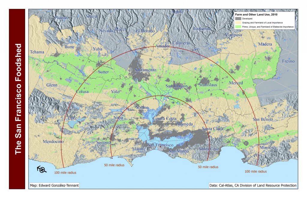
Chapter 1 provides a general introduction to ESRI’s ArcGIS software and includes specific instructions for installing the software. Chapter 2 introduces basic tools and concepts in ArcGIS. Chapter 3 examines the display of thematic data. Participants learn to map different land use classes and create a map representing San Francisco’s foodshed. This exercise allows participants to reproduce the project conducted by the American Farmland Trust’s (AFT) San Francisco Foodshed Report (website). As might be expected, a lively discussion developed following this exercise. Reproducing the AFT’s map demonstrated the selective processes which visualize data (e.g., maps). The exercise allows participants to ask new questions of the resulting maps as they explore geospatial analysis in detail.
Chapter 4 presents numerous forms of distance analysis, including buffer, euclidean, and network (service area) analysis. Chapter 5 explores georeferencing and the creation of spatial data from field research (e.g., GPS data, hand-drawn maps). Chapter 6 examines the analysis and representation of demographic data.
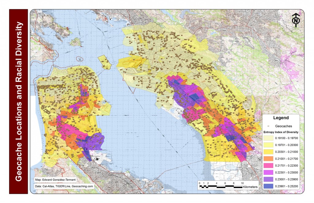
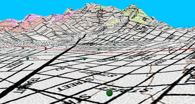
Chapter 7 briefly presents additional visualization techniques, including 3D display of data. This includes the creation of 3D surfaces from contour data.
Participants also learn about the wide range of instructional materials and data portals available via the world wide web. This includes the ESRI online training website (training.esri.com) and Karen Payne’s regularly updated list of geospatial portals (website).
If you participated in the workshop and have questions, comments, or photographs please email me.