This post relates some thoughts on the combination of GIS and game engines for historical archaeology. This approach examines virtual world environments as a type of 3D GIS allowing users to move through space while simultaneously interacting with various data. This immersive, qualitative GIS (IQ-GIS) supports the display and interpretation of both qualitative and quantitative data. While a complete prototype is still some months away, here’s a sneak peak! This post also forces me to cogently express my thoughts for a few upcoming grant proposals.
Virtual Archeology, Digital Archaeology, Cyber-Arch, & New Heritage
Archaeologists were early adopters of geographic information systems (GIS), and the application of such technologies began in earnest during the 1980s (Kvamme 1999). Since the 1980s, the use of GIS has rapidly grown and it is now a central part of the everyday archaeological work in the contract, public, and educational sectors. The core uses of GIS for our discipline center on the creation of distribution maps, development of predictive models, and management of archaeological resources. These remain important elements and ones I regularly teach to graduate students enrolled in Monmouth University’s MA in Anthropology Program. (a plug!)
(I worked for Kathleen Deagan while studying at UFL).
Similarly, when virtual technologies emerged in the late-1970s and 1980s, archaeologists quickly adapted these technologies to our work. The term “virtual archaeology” was first used in the late 1980s to denote the use of 3D models to represent archaeological contexts (Reilly 1990), and centered on the production of images for publication (Forte 1997). Early virtual archaeology focused almost exclusively on monumental or prehistoric archaeology, and particularly on Greek and Roman sites from across Europe.
The increasing affordability of computing hardware in the 1990s allowed more archaeologists to experiment with 3D projects (Koller et al 2009:73). Ultimately, this was a minor aspect of the overall digitization of archaeology, which grew out of the increasing adoption of GIS, global positioning systems (GPS), and remote sensing technologies during the 1980s and 1990s (Kvamme 1999, Zubrow 2006).
Virtual and digital archaeologies center on the documentation and display of archaeological contexts. In contrast, cyber-archaeology focuses on the immersive aspects of online worlds like Second Life. Cyber-archaeology represents “a new way of understanding virtual communities through the study of their cultural artifacts” (Harrison 2009:4), and the ways people in the present explore multiple “potential pasts” created through a variety of digital technologies (Forte 2010:10). While Harrison’s research focuses upon the ways people create online heritage; Forte combines technological experimentation with a concern for the ways people mediate their interaction with the past through technology.
A growing list of scholars are examining the intersection of new media and heritage. New heritage represents the intersection of new media technologies (e.g., virtual world environments) and cultural heritage (Kalay et al., 2008). I have come to view new heritage as a distinct practice for representing archaeological contexts in time and space. New heritage easily accommodates methodologies from a range of disciplines including historical archaeology, oral history, ethnography, and the digital humanities. This approach also supports the use of these technologies to further the goals of collaboration and social justice (González-Tennant 2013).
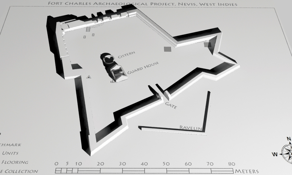
The Fort Charles IQ-GIS
The digital/virtual reconstruction of archaeological contexts is accomplished by one of two methods. The first uses 3D capture technologies to automatically measure objects and structures. This method includes high-priced 3D scanners capable of capturing large structures or smaller instruments for documenting artifacts. In addition, methods inspired by photogrammetry allows users to extract accurate models from a series of photography. A recent paper by Rachel Optiz demonstrates that these two methods increasingly produce similar results.
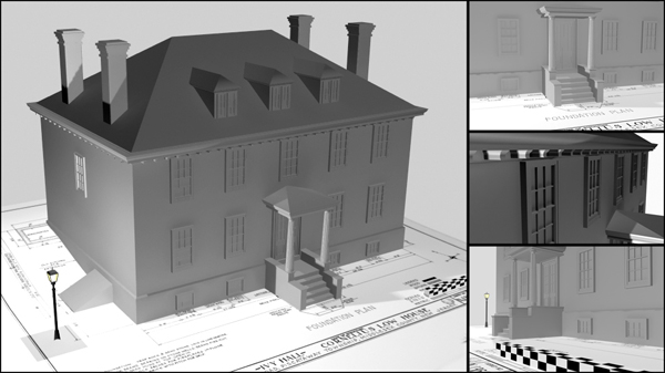
The second method for reconstructing archaeological contexts is referred to as hand modeling, and involves the use of 3D software to create virtual content based on the documentation and interpretation of archaeological data (Koller et al. 2009: 2). A range of expensive (3DS Max), mid-range (SketchUp), and free (Blender) software exist for this type of work.
There are only a handful of historical archaeology projects utilizing these technologies. My research into Rosewood, Florida is one example. Others include USF’s Alliance for Integrated Spatial Technologies’ documentation of Fort Matanzas in St. Augustine and the Virtual Curation Laboratory (VCL) at Virginia Commonwealth University. VCL also uses 3D printing of artifacts for public outreach and museum displays, which is pretty awesome.
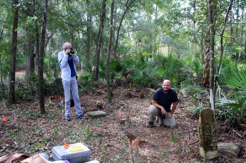
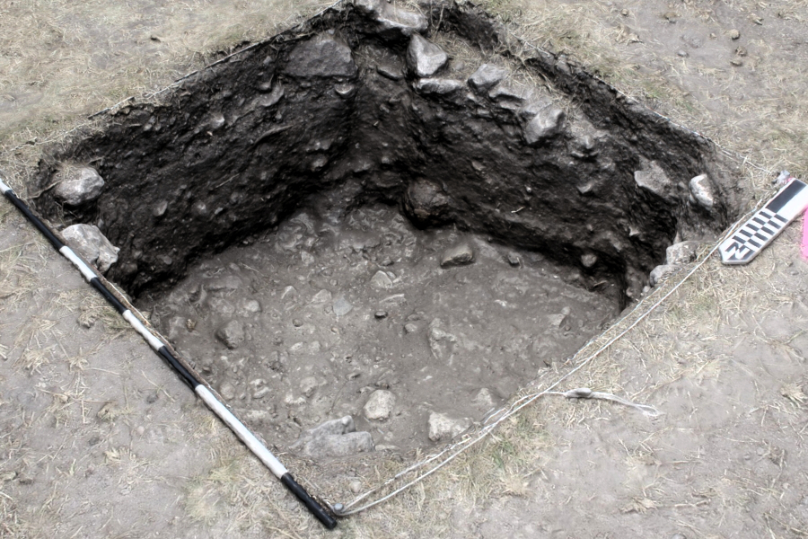
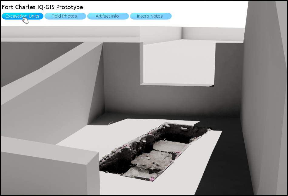
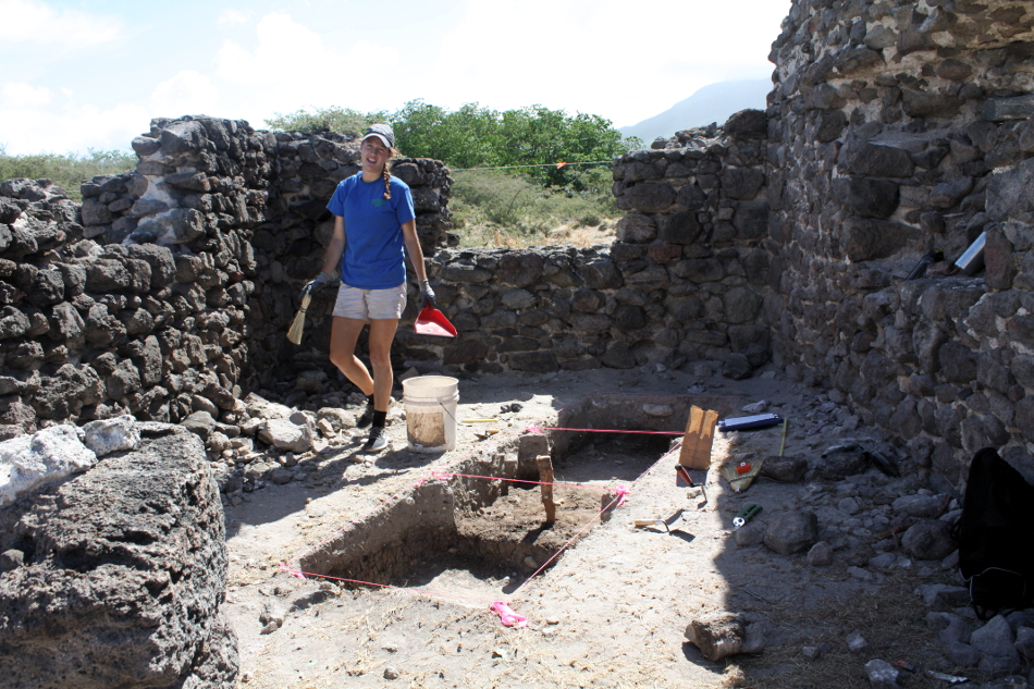
The Fort Charles IQ-GIS is part of a multi-year project in Nevis to examine three centuries of cultural change at one of the Caribbean’s earliest and longest-lived British forts. This includes the use of both scanning technologies and hand modeling to reconstruct the site’s archaeological contexts. Blender is used to reconstruct the fort’s landscape as documented through traditional archaeological methods (e.g., excavation, mapping, measured drawings). Photoscan is used to create accurate and fully-textured models of each excavation unit.
The resulting models of each unit are integrated into 3D models of the site. These models are then loaded into the Unity3D game engine, which supports the rapid creation of virtual world environments. Users of an IQ-GIS interact with various datasets through a series of buttons allowing them to pull up various interpretations of the site as well as descriptions regarding the interpretive decisions made by archaeologists.
What is Qualitative about an IQ-GIS?
The Fort Charles IQ-GIS draws much of its theoretical inspiration from Qualitative GIS (QualGIS). QualGIS involves the use of geospatial technologies for qualitative research and is rooted in a “hybrid understanding of GIS as technology, methodology, and situated social practice” (Elwood and Cope 2009:3). For Elwood and Cope (2009:4-7), QualGIS represents a mixed methods approach for three reasons.
- QualGIS treats knowledge as partial and situated, echoing feminist scholars of science (Haraway 1988).
- QualGIS practitioners subscribe to the idea that epistemology need not determine methodology; data are open to multiple interpretive frameworks.
- QualGIS acknowledges that knowledge is inherently political.
QualGIS situates multiple forms of quantitative and qualitative data alongside one another. This requires a nuanced attention to detail as the act of translating historical knowledge into geospatial formats can result in the loss of qualitative meaning (Schuurman 2009).
An IQ-GIS takes these characteristics and democratizes them for public consumption. A computer with high-speed internet access is all that is required to understand which data and what decisions inform archaeological interpretations. IQ-GIS also conforms to the three characteristics of QualGIS.
- Archaeologists need to take seriously the exploration of alternative forms of dissemination. An IQ-GIS allows users to step inside a three-dimensional site map and access the multiple datasets driving archaeological interpretations.
- Epistemology no longer need dictate specific methodological outcomes. Multiple interpretations can be situated alongside one another. These alternative interpretations can replace one another in the virtual world environment, or be superimposed on the reconstructed landscape.
- IQ-GIS allows archaeologists to address the political nature of their work. The multiple interpretations support a more inclusive archaeology by sharing the archaeological process (e.g., interpretative decisions) with stakeholders.
Concluding Thoughts
While the digital divide continues to restrict equal access to internet technologies, this is changing as computers and access to the internet becomes ubiquitous in many parts of the world. It is up to archaeologists to embrace these technologies. We inhabit a powerful position in society as the public has a inherent interest in historical objects and places. The use of new heritage and creation of IQ-GIS will become more common as computer costs drop and the intuitive nature of software increases. I look forward to the day when such technologies are routinely used by heritage workers. Until then, there’s a lot of exciting work to do!
Portions of this blog post have since appeared in the following publication(s).
González-Tennant, Edward and Diana González-Tennant. 2016. The Practice and Theory of New Heritage for Historical Archaeology. Historical Archaeology: Special Themed Volume on Landscape 50(1):186-203.
References Cited
Cope, Meghan, and Sarah Elwood
2009 Qualitative GIS: A Mixed Methods Approach. Sage Publications, London.
Forte, Maurizio
1997 Virtual Archaeology: Great Discoveries Brought to Life Through Virtual Reality. Thames & Hudson, London.
Forte, Maurizio, editor
2010 Cyber-Archaeology. Archaeopress, London.
Haraway, Donna
1988 Situated Knowledges: The Science Question in Feminism and the Privilege of Partial Perspective. Feminist Studies 14(3):575–599.
Harrison, Rodney
2009 Excavating Second Life: Cyber-Archaeologies, Heritage and Virtual Communities. Journal of Material Culture 14(1):75–106.
Kalay, Yehuda E, Thomas Kvan, and Janice Affleck
2008 New Heritage: New Media and Cultural Heritage. , editorsYehunda E Kalay, Thomas Kvan, and Janice Affleck. Annals of Physics. Vol. 2007. Routledge. http://www.amazon.com/dp/0415773563.
Koller, David, Bernard Frischer, and Greg Humphreys
2009 Research Challenges for Digital Archives of 3D Cultural Heritage Models. ACM Journal on Computing and Clutural Heritage 2(3):1–17.
Kvamme, Kenneth
1999 Recent Direction and Development in Geographical Information Systems. Journal of Archaeological Research 7(2):153–202.
Reilly, Paul
1990 Towards a Virtual Archaeology. In Computer Applications in Archaeology, K Lockyear and S Rahtz, editors. British Archaeological Reports, Oxford.
Schuurman, Nadine
2009 Metadata as a Site for Imbuing GIS with Qualitative Information. In Qualitative GIS: A Mixed Methods Approach, Meghan Cope and Sarah Elwood, editors, pp. 41–56. Sage, London.
Zubrow, Ezra B. W.
2006 Digital Archaeology: A Historical Context. In Digital Archaeology: Bridging Method and Theory, pp. 10–31. Routledge, New York.
Thanks for reading!
Ed